Troy Kimmel Weather

Forecasting Austin and South Central Texas Weather Since 1984

TK’s Special Briefing….

Austin / Travis County and South Central Texas Weather Update #9
Prepared by UT University/Incident Meteorologist Troy Kimmel
445pm CT – Friday / 17 April 2015

Severe Thunderstorm Watch for IH35 Corridor Counties Continues Until 7pm …

… NWS/Austin-San Antonio Issued Flash Flood Watch for Areas East of the IH35
Corridor Counties Until 1am Saturday Morning … This DOES NOT include the
IH35 corridor counties at this time

At 445pm… no severe weather is indicated. Rain showers and thunderstorms are
spreading northward into the Austin metro area and the IH35 corridor counties.
Dangerous and deadly cloud-to-ground lightning is accompanying these
thunderstorms along with periods of heavier rain as well as gusty wind.
This will
make what would, under a clear sky, be an otherwise usual Friday afternoon rush
hour traffic headache into something twenty times as bad. Use caution if you must
be on the roadways.

The latest short range high resolution computer models suggest a fairly progressive
movement of these cells through the area over the next few hours. As a result, rainfall
should remain on the beneficial side.. especially where it falls over the Texas hill country
which is still in drought. Although we need to watch this closely, I’m thinking that we’ll
see some one and two inch rainfall totals across the area with heaviest rainfalls in areas
to our south and southeast in the current flash flood watch area.

I’ll continue to monitor.. tk
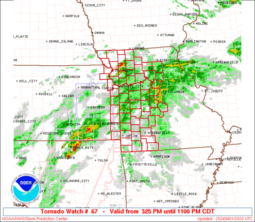
TK’s Special Briefing…. (1158am CT-Fri/17Apr2015)

1158pm CT – Friday / 17 April 2015

…. Authority / NWS Storm Prediction Center ….
See link: http://www.spc.noaa.gov/products/watch/ww0067.html
WW0067 Radar

URGENT – IMMEDIATE BROADCAST REQUESTED
SEVERE THUNDERSTORM WATCH NUMBER 67
NWS STORM PREDICTION CENTER NORMAN OK
1150 AM CDT FRI APR 17 2015

THE NWS STORM PREDICTION CENTER HAS ISSUED A

* SEVERE THUNDERSTORM WATCH FOR PORTIONS OF
WESTERN-NORTH AND CENTRAL TEXAS

* EFFECTIVE THIS FRIDAY MORNING AND EVENING FROM 1150 AM UNTIL
700 PM CDT.

* PRIMARY THREATS INCLUDE…
SCATTERED LARGE HAIL LIKELY WITH ISOLATED VERY LARGE HAIL EVENTS
TO 2 INCHES IN DIAMETER POSSIBLE
SCATTERED DAMAGING WIND GUSTS TO 70 MPH LIKELY
A TORNADO OR TWO POSSIBLE

SUMMARY…THUNDERSTORMS OVER WESTERN AND CENTRAL TX WILL TRACK
EASTWARD ACROSS THE WATCH AREA THIS AFTERNOON AND EARLY
EVENING…CAPABLE OF LARGE HAIL AND DAMAGING WINDS.

THE SEVERE THUNDERSTORM WATCH AREA IS APPROXIMATELY ALONG AND 85
STATUTE MILES EAST AND WEST OF A LINE FROM 35 MILES SOUTHWEST OF
COTULLA TEXAS TO 90 MILES NORTH NORTHWEST OF MINERAL WELLS TEXAS.
FOR A COMPLETE DEPICTION OF THE WATCH SEE THE ASSOCIATED WATCH
OUTLINE UPDATE (WOUS64 KWNS WOU7).

PRECAUTIONARY/PREPAREDNESS ACTIONS…

REMEMBER…A SEVERE THUNDERSTORM WATCH MEANS CONDITIONS ARE
FAVORABLE FOR SEVERE THUNDERSTORMS IN AND CLOSE TO THE WATCH
AREA. PERSONS IN THESE AREAS SHOULD BE ON THE LOOKOUT FOR
THREATENING WEATHER CONDITIONS AND LISTEN FOR LATER STATEMENTS
AND POSSIBLE WARNINGS. SEVERE THUNDERSTORMS CAN AND OCCASIONALLY
DO PRODUCE TORNADOES.