Austin / Travis County and South Central Texas Weather Update
Prepared by Incident Meteorologist Troy Kimmel (www.troykimmelweather.com)
920pm CDT – Wednesday / 30 October 2013
… Heavy Thunderstorms Occurring in Some Areas … Flash Flood Warnings Issued ….
… NWS Storm Prediction Center Issues Mesoscale Discussion …
At 916pm… the NWS issued a FLASH FLOOD WARNING for central Travis and
central Williamson counties…
BULLETIN - EAS ACTIVATION REQUESTED
FLASH FLOOD WARNING
NATIONAL WEATHER SERVICE AUSTIN/SAN ANTONIO TX
916 PM CDT WED OCT 30 2013

THE NATIONAL WEATHER SERVICE IN AUSTIN SAN ANTONIO HAS ISSUED A

* FLASH FLOOD WARNING FOR...
  CENTRAL TRAVIS COUNTY...
  CENTRAL WILLIAMSON COUNTY...

* UNTIL MIDNIGHT CDT.

* AT 913 PM CDT...NATIONAL WEATHER SERVICE METEOROLOGISTS HAVE
  DETERMINED THAT RAINFALL ESTIMATES FROM DOPPLER RADAR INDICATE SLOW
  MOVING THUNDERSTORMS WITH VERY HEAVY RAINFALL ACROSS THE WARNED
  AREA. RAINFALL RATES OF ONE TO TWO INCHES PER HOUR WITH LOCALIZED
  AMOUNTS TO 4 INCHES WILL BE POSSIBLE AND CELLS TRAIN OR MOVE
  ACROSS THE SAME LOCATIONS.

* RUNOFF FROM THIS EXCESSIVE RAINFALL WILL CAUSE FLASH FLOODING TO
  OCCUR. SOME LOCATIONS THAT WILL EXPERIENCE FLOODING INCLUDE...
  ANDERSON MILL...AUSTIN...CEDAR PARK...GEORGETOWN...GRANGER...
  PFLUGERVILLE...ROUND ROCK...SERENADA...TAYLOR...WINDEMERE...BEE
  CAVE...GEORGETOWN DAM...GRANGER DAM...HUTTO...JARRELL...MANSFIELD
  DAM...ROLLINGWOOD...SUN CITY...WEIR AND WEST LAKE HILLS.

  SEVERAL LOW WATER CROSSING ARE CLOSED ACROSS WESTERN AND NORTHERN
  TRAVIS COUNTY.

---
The NWS Storm Prediction Center has issued a mesoscale discussion regarding the
possibility of a severe weather watch…

Link to the discussion: http://www.spc.noaa.gov/products/md/md1986.html
tk
—
Austin / Travis County and South Central Texas Weather Update
Prepared by Incident Meteorologist Troy Kimmel (www.troykimmelweather.com)
515pm CDT – Wednesday / 30 October 2013
… So Far… So Quiet (Mostly) …
… Rainfall Event Still On Tap for Later Tonight into the Morning Hours Tomorrow ….
As of 5pm this Wednesday afternoon.. rain showers and thunderstorms have mostly been
slow to develop across the area. Even with breaks in the clouds and relatively strong
surface heating, which should be supportive in thunderstorm development, we just haven’t
seen much activity across the area.
I think this means that we’re going to have to wait until the main dynamic lift arrives later
tonight as the upper level low pressure storm passes to our north later tonight into the
morning hours tomorrow. I’m not changing the forecast that much.. just shifting the start
time more into the evening and nighttime hours tonight.
Forecast rainfall amounts will continue to be in the 1 to 3 inch range with isolated heavier
amounts. The NWS/Austin San Antonio continues their FLASH FLOOD WATCH valid to
go into effect at 7pm tonight and to continue until midday tomorrow.
Here is the latest (just updated) WPC rainfall forecast guidance, valid from 7pm tonight
through 7pm tomorrow night…
http://www.hpc.ncep.noaa.gov/qpf/94qwbg.gif
There is, in addition, a “slight” risk of severe thunderstorms for our area, as outlined in
current NWS Storm Prediction Center outlooks primarily between now and 12 midnight
tonight.
I’ll continue to keep you informed.
tk
—
102pm CT – Wednesday / 30 October 2013
…. NWS Storm Prediction Center Issues Mesoscale Discussion ….
…. Severe Weather Watch Possible (Mainly to our North through Northeast) ….

Here is link:
http://www.spc.noaa.gov/products/md/md1982.html
I’ll continue to keep you advised.. tk
—
Austin / Travis County and South Central Texas Weather Update
Prepared by Incident Meteorologist Troy Kimmel (www.troykimmelweather.com)
1245pm CDT – Wednesday / 30 October 2013
… Severe Thunderstorm Risk Added to Flood Risk with Passing System …
Things are still progressing as far as our upcoming rain event. The timing for the
beginning of precipitation may be moving back a little into mid and late afternoon today but
otherwise the event forecast hasn’t changed that much.
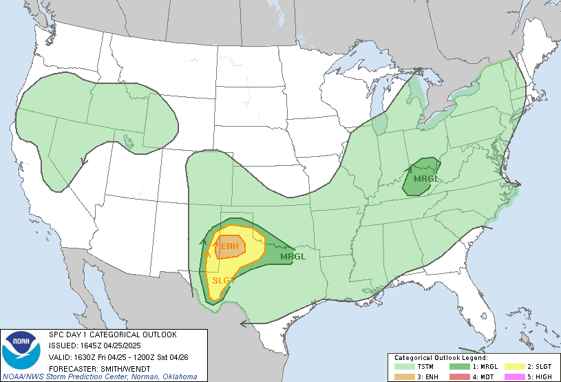
One thing to note… the NWS/Storm Prediction Center has placed all of our area in
a “slight” risk of severe thunderstorms.. main risks will be hail and strong straight line
thunderstorm winds.. later today (most likely starting around the evening rush hour) through
tonight and into the early morning hours tomorrow.
Here is the graphic for the day one outlook..

While here is the link to their full day one severe weather outlook…
http://www.spc.noaa.gov/products/outlook/day1otlk.html
A reminder.. the NWS/Austin-San Antonio has issued a FLASH FLOOD WATCH for
all of our area effective at 7pm tonight continuing through noon tomorrow.
tk
—
Austin / Travis County and South Central Texas Weather Update
Prepared by Incident Meteorologist Troy Kimmel (www.troykimmelweather.com)
530pm CDT – Tuesday / 29 October 2013
.. Beneficial Rainfall Event Unfolding for Tomorrow into Thursday ..
.. Periods of Heavy Rain, At Times, May Cause Localized Flooding Problems ..
.. As The Upper Air Storm System Departs the Area Thursday, Cooler and Drier Air Sweeps In ..
Late on this Tuesday afternoon, south southeasterly surface winds continue to bring abundant low
level moisture northward from the Gulf of Mexico. At mid and upper levels of the atmosphere, a
strong upper level low.. situated over central Nevada.. is, in its broad counterclockwise flow, bringing
Pacific moisture, in the form of mid and high level cloudiness, northeastward into Texas.
As the upper air low pressure storm system moves eastward into the plains tomorrow into
Thursday, we’ll see increasing atmospheric lift and instability overhead with scattered to numerous
rain showers and thunderstorms developing overhead by tomorrow morning with the activity persisting
through tomorrow night into Thursday. As the upper air system departs northeastward toward the Great
Lakes, this will support drier surface air to move into our area by Thursday midday into afternoon with
precipitation tapering off and then a surface cold front to sweep southeastward across the area
Thursday evening.
…. Hazards ….
Heavy rain / flooding threat… MODERATE …
Current NWS WPC guidance suggests upwards of 1 to 3 inches of rain, in general, areawide between
now and Thursday afternoon. Isolated heavier totals are possible. For most areas, this will be a beneficial
rainfall with continued drought relief. In areas where we’ve seen heaviest totals in the past few weeks,
we’re likely to see some localized flooding problems.. especially in urban areas and in the typical low water
crossings.
At this point, the NWS/Austin-San Antonio has not issued a flash flood watch, but they say that is certainly
possible as this event unfolds and they take continue to watch updated rainfall forecasts and the latest
forecast guidance. NWS small stream/urban flood advisories are very likely with this system while NWS
flash flood warnings are possible.
A reminder.. from the NWS.. “turn around, don’t drown.”
Remember, too, that flash flood deaths are preventable as long as you use common sense and avoid flood
prone areas. If you don’t use common sense, you not only involve yourself in a flooding situation, but you
also force a first responder into putting themselves at risk to rescue you because you didn’t make a good
decision.
Severe thunderstorm threat… VERY LOW …
The NWS Storm Prediction Center day two severe weather outlook…
http://www.spc.noaa.gov/products/outlook/day2otlk.html …
keeps the “slight” risk area well north of our area. Given the very moist environment,
any hail or straightline thunderstorm threat locally will likely remain very low with the risk mainly to
our north where better atmospheric instability and dynamics will exist closer to the track of the upper
level low.
Lightning threat…. VERY HIGH …
Deadly cloud-to-ground lightning will be a threat and problem through the lifetime of this event.
…. ABIA Interests ….
Scattered to numerous rain showers and thunderstorms are likely beginning tomorrow (Wednesday)
morning and continuing through the morning into midday hours Thursday as this upper level low pressure
system moves west-to-east to the north of our local area. Dangerous cloud to ground lightning will be a
threat and problem through the lifetime of the event with NWS/Austin-San Antonio likely to issue airport
weather warnings (AWW) through the period. Periods of heavy rain and associated reduced visibility will
occur with upwards of 1 to 3 inches of rain likely to be observed at the ABIA aerodrome.
DAL/DFW as well as HOU/IAH hub operations will, in addition, be affected by this storm system with
delays and diversions a strong possibility in the Wednesday.. Wednesday night into early Thursday time
period as thunderstorms affect these aerodromes and the Fort Worth/Houston FAA Center airspace.
I’ll continue to keep you informed regarding this upcoming inclement weather period.
tk


